Lake Winn Resources Corp. (“Lake Winn” or the “Company”) ( TSXV:LWR ) ( OTC:EQTXF ) is pleased to announce that it has received the final data from the drone based airborne magnetic survey regarding the Cloud project in the Flin Flon gold belt, Manitoba.
The survey was flown by Stratus Aeronautics Inc. based out of Burnaby BC. The survey was flown at 50m line spacings on a north-south grid. The work is designed to assist in the understanding of the geology of the Cloud project.
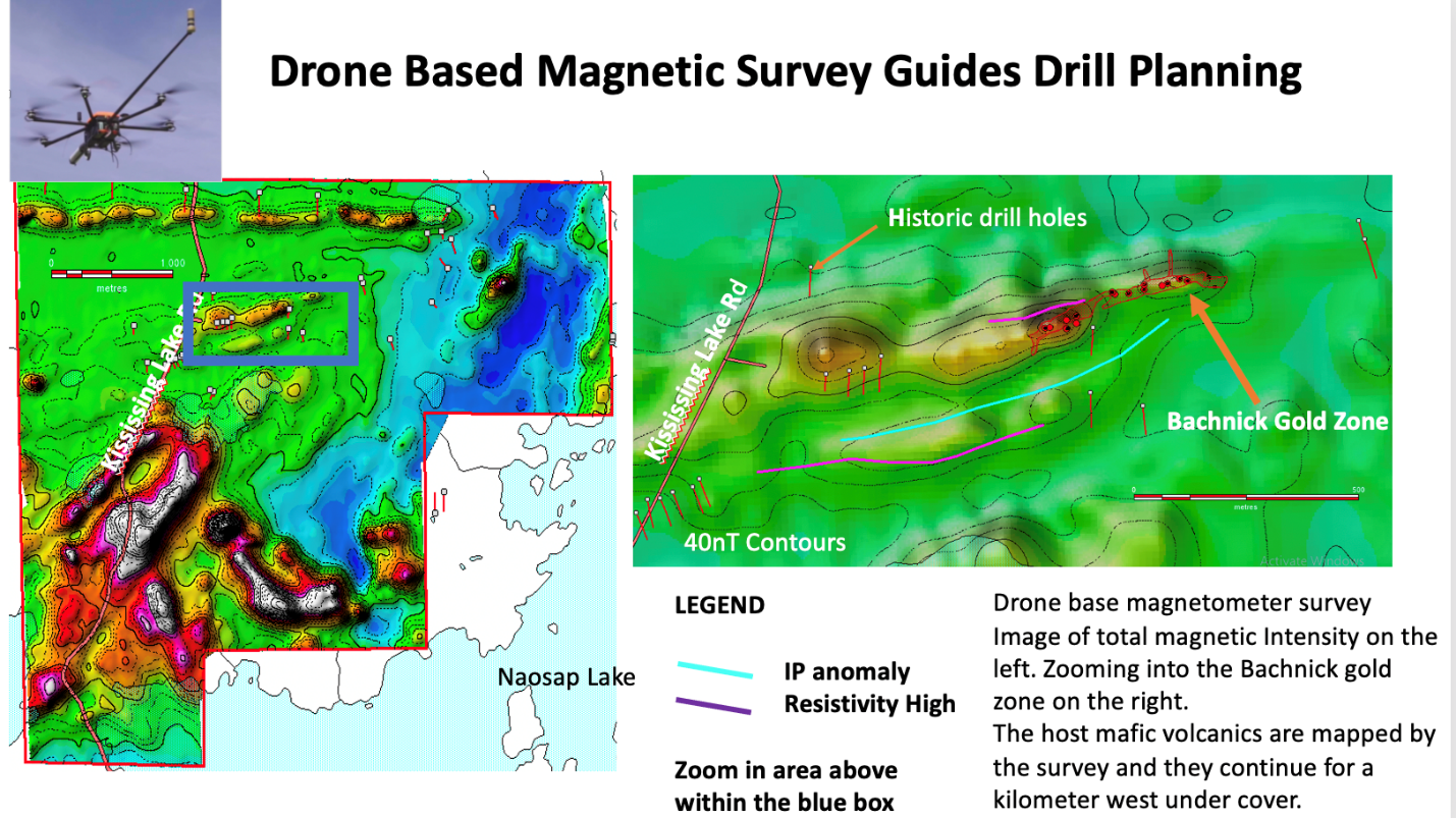
The magnetic data has immediately shown to map the mafic meta-volcanics that host 320m by 50m Bachnick gold zone and also demonstrates that this geology continues to the west under cover for an additional 1km. This unit, a “greenstone” is thought to host the gold mineralization and this will be the prime target for drill testing which commences next week. The parallel and adjacent IP and Resistivity anomalies will also be tested by drilling. Figure 1 depicts this data. Interpretation of the magnetic data will continue with a focusing on mapping structures.
Click Image To View Full Size
Figure 1: Airborne total magnetic intensity image of the Cloud Project
Qualified Person
The Qualified Person for this news release is Buddy Doyle, AUSIMM, a Geologist of over 30 years’ experience in mineral exploration, discovery, and evaluation. A Qualified Person under the provisions of National Instrument 43-101.
About Lake Winn
Lake Winn Resources Corp., is a Vancouver based gold company, listed on the TSX Venture Exchange (Symbol: LWR) focusing on exploration and development of gold projects in Canada. The company’s flagship property, the Cloud Project is in the province of Manitoba, in the Flin Flon Gold Belt approximately 40 kilometers north‐east of the town of Flin‐Flon. Access to the property is provided by Manitoba highway 10 to the all‐weather Kississing Lake Road. The company is currently preparing for diamond drilling.
On Behalf of the Board of Directors of Lake Winn Resources Corp.
Patrick Power, President & CEO
+1 (604) 218-8772